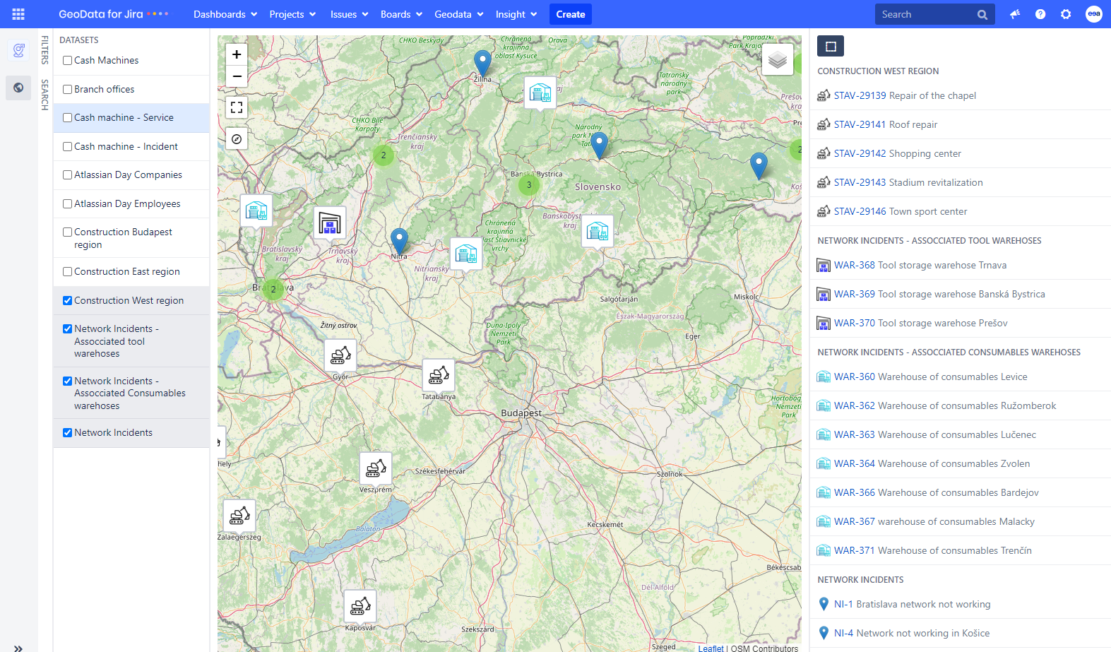
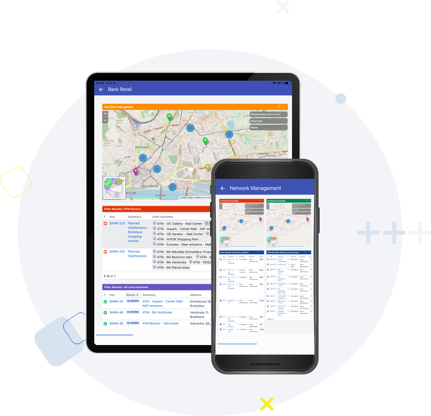
Manage Jira tasks and Insight objects on a map using their GPS location. Take advantage of the optimization of service or business activities in a given location.
Every company that has work spread over buildings, streets, cities, or even countries, the company’s work is linked to a specific place and its employees travel to those places to service or repair various equipment or buy or sell certain assets.
When we see our data on the map, we see everything much more clearly. We immediately have an overview of which areas are the busiest, we can easily plan a trip for our employee, our strategic decisions will be incomparably more effective and we can even find geographical connections between the various problems and tasks we are currently dealing with. In addition, thanks to data visualization, we save time and other valuable resources in the company.
Data visualization is a great helper for companies or institutions from various industries.
Pyronova, a company specializing in fire protection, uses GeoData to visualize the location of fire extinguishers throughout the country. The application thus enables the company to more effectively plan regular service or trips of technicians to the equipment that needs to be repaired.
Our application is also actively used by Baumit, a company which focuses on building materials. On the map, you can always find an overview of current constructions and related tasks with information about the need to supply additional materials.
GeoData is priced per user, starting at $1 per user. The more users you have, the cheaper the price per user is. Pricing also differs depending on your hosting options. If you want to know more about our pricing, visit the Atlassian Marketplace.
Get a 30-day free trial of GeoData’s full functionality by installing this Jira plugin from the Atlassian Marketplace. Once your admin has installed GeoData, all users can enjoy a free trial for 30 days, after which a fee is required to continue using the app.
Yes we do! We can show you a demo on a video call. We will also assist your admin during the configuration. And if any if you bump into any issue, you can submit your ticket through our service desk.
There are many cases where GeoData for Jira can be used. To give you two examples:
A local government office registers and resolves suggestions from citizens in Jira and publishes opinions on them, using Geodata to clearly display selected data about the suggestions on a map on its portal for citizens.
A construction companyuses our app to maintain a map of installed metering and fire extinguishing equipment at a customer's site. It uses visualization on the map to manage onsite service interventions, i.e., they optimize their workflow using the map.
Yes it does! GeoData for Jira provides external linking to web services like Google Maps. You can plan a trip using Google Maps routes from Jira issues and also handle GeoData Insight object custom fields for Google routes.
You can connect GeoData with OpenStreeMap. Furthermorae, our product roadmap covers integration with other GIS providers. You can also connect GeoData with weather services.
This website uses cookies so that we can provide you with the best user experience possible. Cookie information is stored in your browser and performs functions such as recognising you when you return to our website and helping our team to understand which sections of the website you find most interesting and useful.
Strictly Necessary Cookies
Strictly Necessary Cookie should be enabled at all times so that we can save your preferences for cookie settings.
If you disable this cookie, we will not be able to save your preferences. This means that every time you visit this website you will need to enable or disable cookies again.
3rd Party Cookies
This website uses Google Analytics to collect anonymous information such as the number of visitors to the site, and the most popular pages.
Keeping this cookie enabled helps us to improve our website.
Please enable Strictly Necessary Cookies first so that we can save your preferences!